
Todd County Aerial Photo Indexes
What is an aerial photo index?
Print versions of the indexes are available at the Borchert Map Library.
See the Minnesota Aerial Photography Holdings - Todd County for a complete list of available photos.
Jump to: 1939 | 1953 | 1957 | 1963 | 1979 | 1990
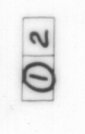
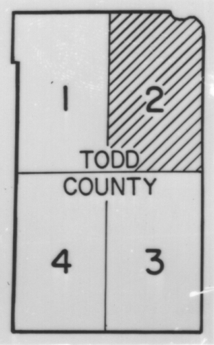
1939There are multiple pages for this index. Choose the page and format below. | |||
| Index Key | jpg | tiff | |
|---|---|---|---|
 |
|||
| Sheet 1 | Sheet 1 | Sheet 1 | |
| Sheet 2 | Sheet 2 | Sheet 2 | |
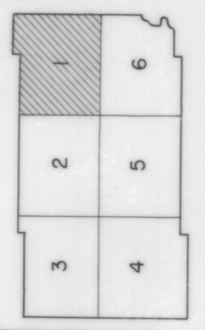
1953There are multiple pages for this index. Choose the page and format below. | |||
| Index Key | jpg | tiff | |
|---|---|---|---|
 |
|||
| Sheet 1 | Sheet 1 | Sheet 1 | |
| Sheet 2 | Sheet 2 | Sheet 2 | |
| Sheet 3 | Sheet 3 | Sheet 3 | |
| Sheet 4 | Sheet 4 | Sheet 4 | |
| Sheet 5 | Sheet 5 | Sheet 5 | |
| Sheet 6 | Sheet 6 | Sheet 6 | |
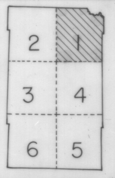
1957There are multiple pages for this index. Choose the page and format below. | |||
| Index Key | jpg | tiff | |
|---|---|---|---|
 |
|||
| Sheet 1 | Sheet 1 | Sheet 1 | |
| Sheet 2 | Sheet 2 | Sheet 2 | |
| Sheet 3 | Sheet 3 | Sheet 3 | |
| Sheet 4 | Sheet 4 | Sheet 4 | |
| Sheet 5 | Sheet 5 | Sheet 5 | |
| Sheet 6 | Sheet 6 | Sheet 6 | |
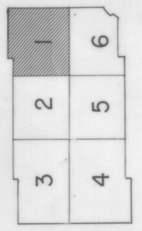
1963There are multiple pages for this index. Choose the page and format below. | |||
| Index Key | jpg | tiff | |
|---|---|---|---|
 |
|||
| Sheet 1 | Sheet 1 | Sheet 1 | |
| Sheet 2 | Sheet 2 | Sheet 2 | |
| Sheet 3 | Sheet 3 | Sheet 3 | |
| Sheet 4 | Sheet 4 | Sheet 4 | |
| Sheet 5 | Sheet 5 | Sheet 5 | |
| Sheet 6 | Sheet 6 | Sheet 6 | |
1979There are multiple pages for this index. Choose the page and format below. | |||
| Index Key | jpg | tiff | |
|---|---|---|---|
 |
|||
| Sheet 2 | Sheet 2 | Sheet 2 | |
| Sheet 3 | Sheet 3 | Sheet 3 | |
| Sheet 4 | Sheet 4 | Sheet 4 | |
1990There are multiple pages for this index. Choose the page and format below. | |||
| Index Key | jpg | tiff | |
|---|---|---|---|
| No index key available. | |||
| Sheet 1 | Sheet 1 | Sheet 1 | |